Weather Channel Forecast August 11 2024
|
Getting your Trinity Audio player ready...
|
By Alric Lindsay
The National Hurricane Center has announced that a potential weather system, which is anticipated to develop into Tropical Storm Ernesto, might make landfall in the Caribbean early this week.
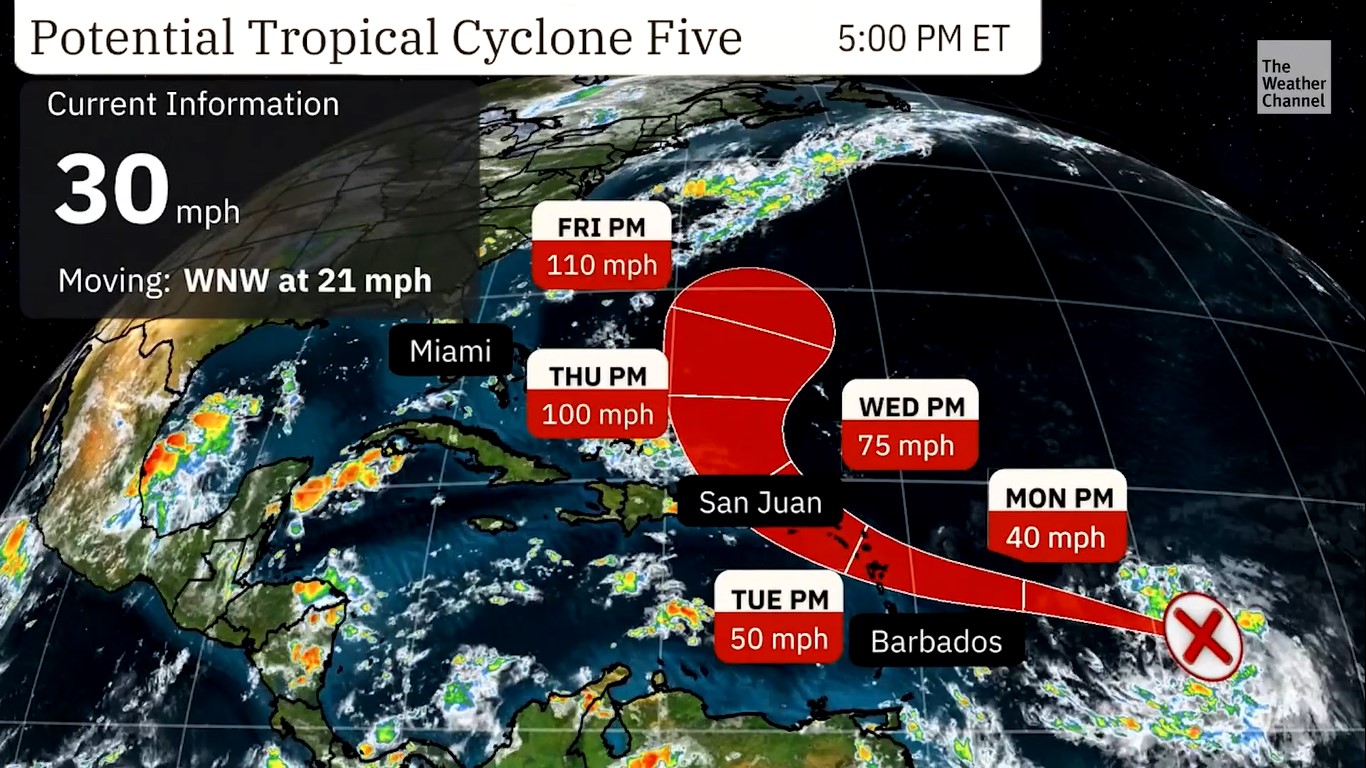
According to the National Hurricane Center, the weather disturbance is currently positioned near latitude 13.9 North, longitude 49.1 West, approximately 875 miles (1405 km) east-southeast of Antigua. The system is moving west-northwest at a speed of 23 mph (37 km/h). It has maximum sustained winds of around 30 mph (45 km/h) with higher gusts.
If the forecast track remains unchanged, it is expected to attain tropical storm status by late Monday.
The National Hurricane Center states that there is an 80 per cent chance of formation within the next 48 hours and a 90 per cent chance of formation within the next 7 days.
In terms of islands in the crosshairs, the Leeward Islands will experience the effects by Tuesday.
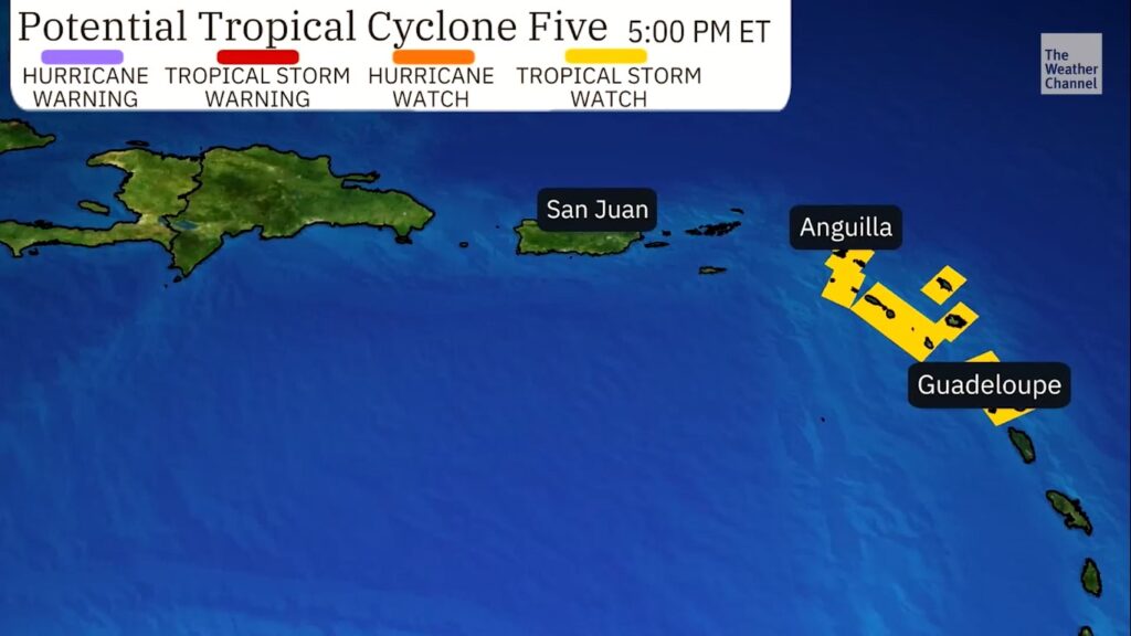
A Tropical Storm Watch is in effect for:
* Guadeloupe
* St. Kitts, Nevis, Montserrat, Antigua, Barbuda, and Anguilla
* Saba and St. Eustatius
* St. Martin
* Sint Maarten
(Image source: The Weather Channel)
The National Hurricane Center added:
Interests elsewhere in the Leeward Islands, the British and U.S. Virgin Islands, and Puerto Rico should monitor the progress of Potential Tropical Cyclone Five.
Additional watches could be required later tonight or early Monday.
Interests in the Caribbean should continue to monitor this weather disturbance as forecasts may change at any time. Particular attention should be paid to local weather stations, which can provide updates on the proximity of bad weather and its likely impacts.