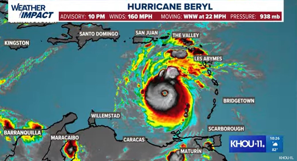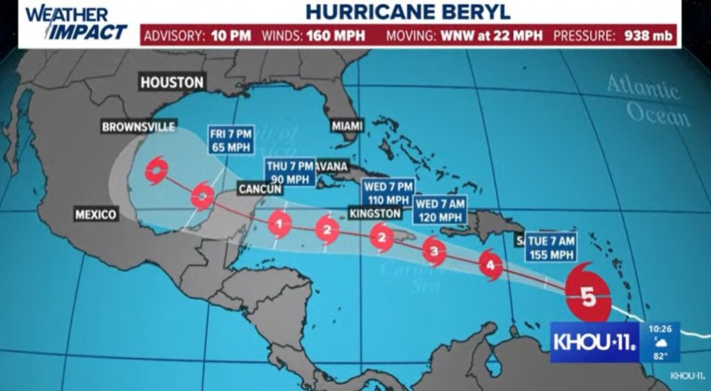
Hurricane Beryl (Image Source: KHOU 11)
|
Getting your Trinity Audio player ready...
|
The National Hurricane Center reported tonight, July 1, 2024, that Beryl intensified into a category 5 hurricane and described its current strength as “potentially catastrophic.”
To get down to specifics, Hurricane Beryl has maximum sustained winds of 160 mph (260 km/h) and is moving west-northwest at 22 mph.
Hurricane-force winds extend outward up to 40 miles (65 km) from the centre, and tropical-storm-force winds extend outward up to 125 miles (205 km).
According to the projection provided by KHOU 11 News below, Hurricane Beryl is heading toward Jamaica. Beryl is currently about 840 miles (1355 km) east-southeast of Kingston, Jamaica, and is expected to approach Jamaica by Wednesday.

Given the forecast, the National Hurricane Center said the following warnings are in effect:
- A Hurricane Warning is in effect for Jamaica.
- A Tropical Storm Warning is in effect for:
- South coast of the Dominican Republic from Punta Palenque westward to the border with Haiti
- South coast of Haiti from the border with the Dominican Republic to Anse d’Hainault
In terms of impacts, Hurricane Beryl is expected to produce rainfall totals of 4 to 8 inches, with localized maxima of 12 inches, in portions of Jamaica on Wednesday.
This rainfall may cause flash flooding in vulnerable areas.
Rainfall from outer bands of Beryl may impact portions of Hispaniola.
A storm surge could raise water levels by as much as 3 to 5 feet above normal tide levels in areas with onshore winds along Jamaica’s immediate coast.
Storm surge could raise water levels by as much as 1 to 3 feet above ground level in areas of onshore winds along the southern coast of Hispaniola.
Interests in the Cayman Islands, Jamaica and Hispaniola are encouraged to stay prepared and alert as Hurricane Beryl develops.


