Tropical Storm Francine Expected To Strengthen As A Hurricane In The Gulf Of Mexico. Two Tropical Depressions Also Projected In The Central Tropical Atlantic

|
Getting your Trinity Audio player ready...
|
By Alric Lindsay
The National Hurricane Center and the Weather Channel reported today, September 10, 2024, that Tropical Storm Francine is expected to strengthen into a hurricane in the Gulf of Mexico. They also provided updates on two tropical depressions in the Central Tropical Atlantic.
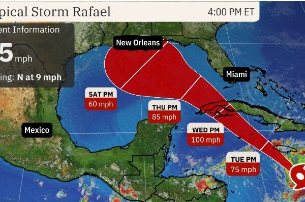
As of the report, the centre of Tropical Storm Francine was located near latitude 24.5 North, longitude 95.9 West, moving north at 5 mph (7 km/h). It is expected to continue northward this morning, followed by a northeast turn with an increase in forward speed.
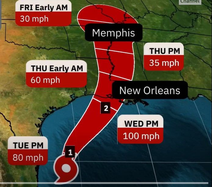
The forecast track indicates that Francine is likely to pass just offshore of northeastern Mexico and southern Texas before making landfall in Louisiana on Wednesday.
The storm currently has maximum sustained winds near 65 mph (100 km/h) with higher gusts and is projected to strengthen into a hurricane before reaching the coast, with significant strengthening expected.
A Storm Surge Warning is in effect for High Island Texas to the Mouth of the Mississippi River Louisiana and Vermilion Bay.
A Hurricane Warning is in effect for the Louisiana coast from Sabine Pass eastward to Grand Isle/
A Storm Surge Watch is in effect for the mouth of the Mississippi River Louisiana to the Mississippi/Alabama border, Lake Maurepas and Lake Pontchartrain.
A Tropical Storm Warning is in effect for Morgan City to Grand Isle, High Island to Sabine Pass, Mouth of the Rio Grande to Port Mansfield, La Pesca Mexico to the Mouth of the Rio Grande and East of Grand Isle Louisiana to Mouth of the Pearl River, including metropolitan New Orleans, Lake Pontchartrain and Lake Maurepas.
A Tropical Storm Watch is in effect for Barra del Tordo to La Pesca Mexico and Port Mansfield to High Island Texas.
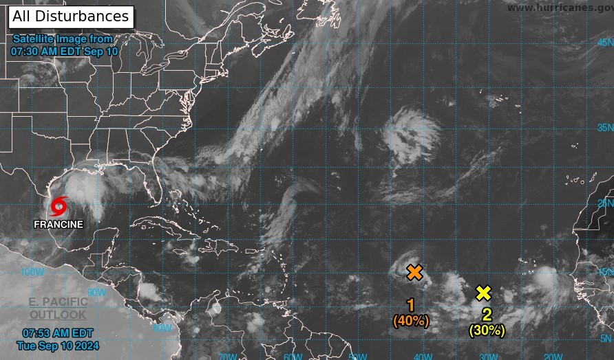
In addition to Tropical Storm Francine, there are two systems in or near the Central Tropical Atlantic.
One is an area of low pressure that could develop into a tropical depression as it moves westward at 5 to 10 mph over the next couple of days.
The formation chance through 48 hours is medium at 40 per cent.
The formation chance through 7 days is medium, at 40 per cent.
The other disturbance is a trough of low pressure located several hundred miles southwest of the Cabo Verde Islands. Over the next couple of days, it is expected to interact and merge with a strong tropical wave located between the west coast of Africa and the Cabo Verde Islands.
The combined system will likely develop into a tropical depression late this week as the system moves west-northwestward at 10 to 15 mph.
The formation chance through 48 hours is low at 30 per cent.
The formation chance through 7 days is high at 70 per cent.
Stakeholders in or near these areas are encouraged to monitor these systems, as forecasts may change at any time. They should pay particular attention to updates from local weather stations and official government releases regarding dangers specific to relevant areas.